Dangerous Areas
Portland's High Crash Network
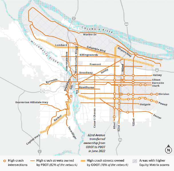
The Portland Bureau of Transportation identifies the streets and intersections with the highest concentrations of serious crashes as the High Crash Network.
The High Crash Network represents only about 8% of Portland streets, yet an average of 67% of Portland's traffic deaths occurred on the network from 2020 through 2024.
Many of these streets are wide, fast, multilane roadways that can be particularly dangerous for people walking, biking, or crossing the street. The burden of traffic violence also falls disproportionately on some Portland communities, making street safety an issue of equity as well as transportation.
The map below shows Portland's High Crash Network and the areas where serious traffic crashes are concentrated.
Traffic deaths are not an inevitable consequence of getting around our city. Identifying where people face the greatest danger can help Portland prioritize street design, speed management, and other safety improvements where they are needed most.
Image from https://www.portland.gov/transportation/vision-zero/high-crash-network-streets-and-intersections